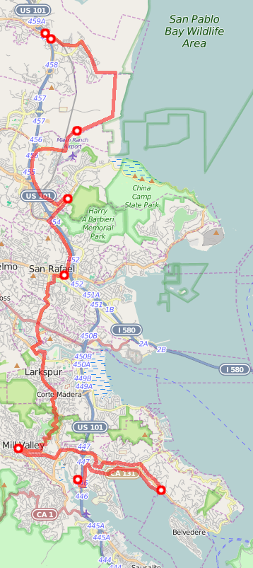
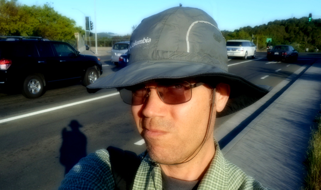
On the morning of Friday, March 27 2015, I hopped out of the Golden Gate Transit 70 bus onto the Ignacio Ave bus pad in Novato, CA. I got out of the way of the other disembarkers. I fiddled with my phone and some folded-up printouts.
I looked at the top of the topmost printout and finalized my first choice: Toast. I would go to the local restaurant named Toast. This would be my first stop in my multi-day walk around San Francisco Bay. And/or most of the way around the combination of San Francisco Bay and San Pablo Bay. And/or something like that. Toast served breakfast, and surely I'd need plenty of energy so that I could walk all day.

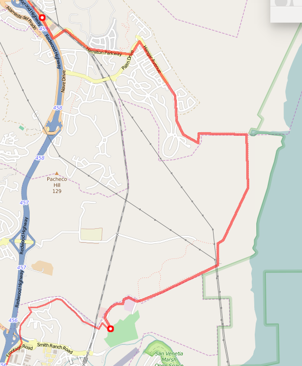
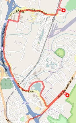
The printouts were a sort of multiple-choice itinerary. At the top were a few popular Foursquare check-in places within a few miles of this bus pad. Next came a list of places within a few miles a spot several miles south. And then another list of places several miles past that. And so on, forming a list of places to visit around the bay. I would not try to visit all of them, but I hoped to visit one place from each set.
I wanted to walk most of the way around the bay, visiting interesting places along the way. Travel guides paid scant attention to places outside San Francisco proper. Popular Foursquare checkins could be interesting.
Finding places within a few miles of several evenly-spaced points had been interesting. I'd gone high-tech: I drew a big circle on a clear sheet of plastic and then taped the plastic so that it draped over the front of my monitor. When I positioned my browser window correctly, this gave me a circle overlayed on top of a Foursquare map. It's a few weeks later, I still have that circle hanging over my monitor, drawing my attention to one section of my screen. Anyhow.
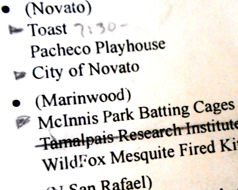
My first set of choices: Toast, Pacheco Playhouse, City of Novato. The playhouse probably wasn't open on a weekday morning. Choosing a wide area like "City of Novato" seemed like taking the easy way out: I might use it as a last resort if no other choice was something a wanderer could "drop in" on. But Toast was open; I'd looked up its information on the internet the evening before and seen that it opened at 7:30 in the morning. I chose Toast.
I was in Novato, though. So, as I got my act together and started walking towards Toast, I used Swarm to check in to the City of Novato. I could check in to each place I encountered and– I scanned the list. Even if I only visited one place in each area, I was going to "bump into" more in passing. If I checked into all of those on Swarm, that would be a lot of notifications for Swarm followers to wade through. Surely, I'd be noisy enough just checking into the places that I'd chosen.
Take heart, Swarm friends: it could have been worse. Sorry. Thank you for putting up with me.
My other important piece of paper was a paper map. When I'd told Nancy Groschwitz about this long-walk-idea, she'd given me her map of the San Francisco Bay Trail. This was a map for folks who wanted to walk around the bay sticking close to the water. This map had dotted lines in places where there wasn't a good pedestrian path around the bay. These were good places to know about—this is what had convinced me to not try to walk the bay's northern border, a.k.a. Highway 37, and instead settle for walking around most of the bay.
Resources, plans: it all sounds like I was very organized. But mostly I wasn't trying to nail down details. Each evening, I'd look up information about the first few places I might visit, figure out when they opened.
A few minutes later, I strolled into Toast, had some french toast. It was fancy french toast, encrusted in corn flakes. I liked the texture. I liked the way this journey was going: pretty easy so far.
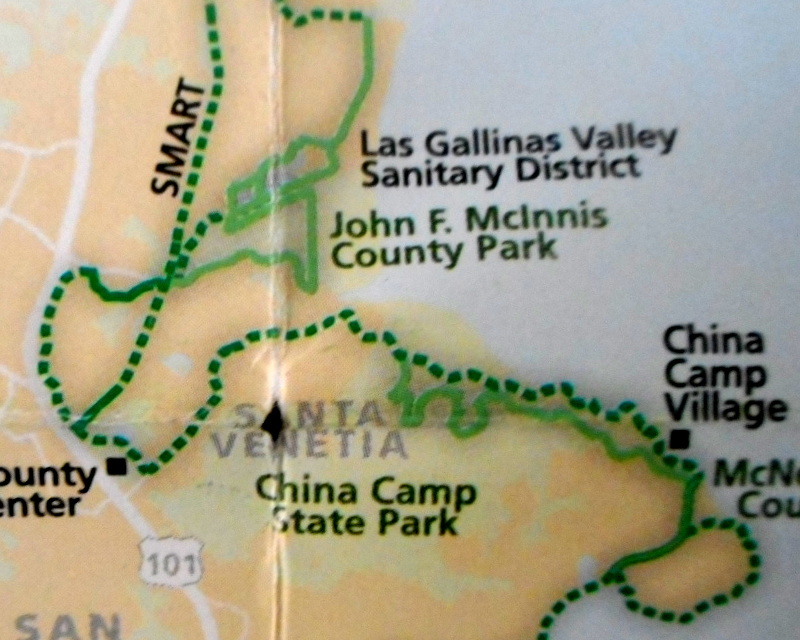
As I ate, I pulled out my printout and looked at my destination choices for the next "leg": McInnis Park Batting Cages, Tamalpais Research Insitute, WildFox Mesquite Fired Kitchen. The Tamalpais Research Insitute was a music recording studio and didn't necessarily look like a place a wanderer could "drop in" on. WildFox wasn't open until later and looked like it specialized in Food I Don't Like. The McInnis Park Batting Cages weren't open this early in the morning. Hmm—but I could take a long cut there. Instead of trudging along next to noisty Highway 101, I could walk a trail through the wetlands by the bay. It would take longer, but by the time I reached the batting cages, they'd be open.
I headed bayward through Novato's Hamilton neighborhood. In the past, Hamilton Air Force Base had been around here. But that was long gone now. I walked through quiet suburban residential streets. If I wanted an interesting walk, I wasn't on the right track: here were homes, not thrills. I walked along, figuring I was just another vato en Novato. I wondered how much Novato-ites got teased for their town's name. Then I reached a park, and there was the start of a trail through the wetlands.
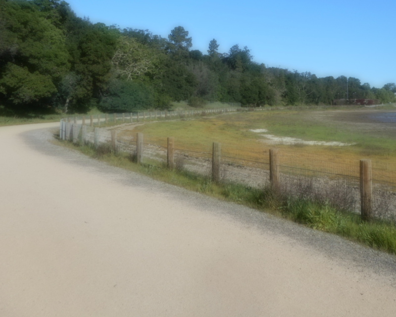
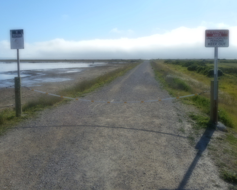
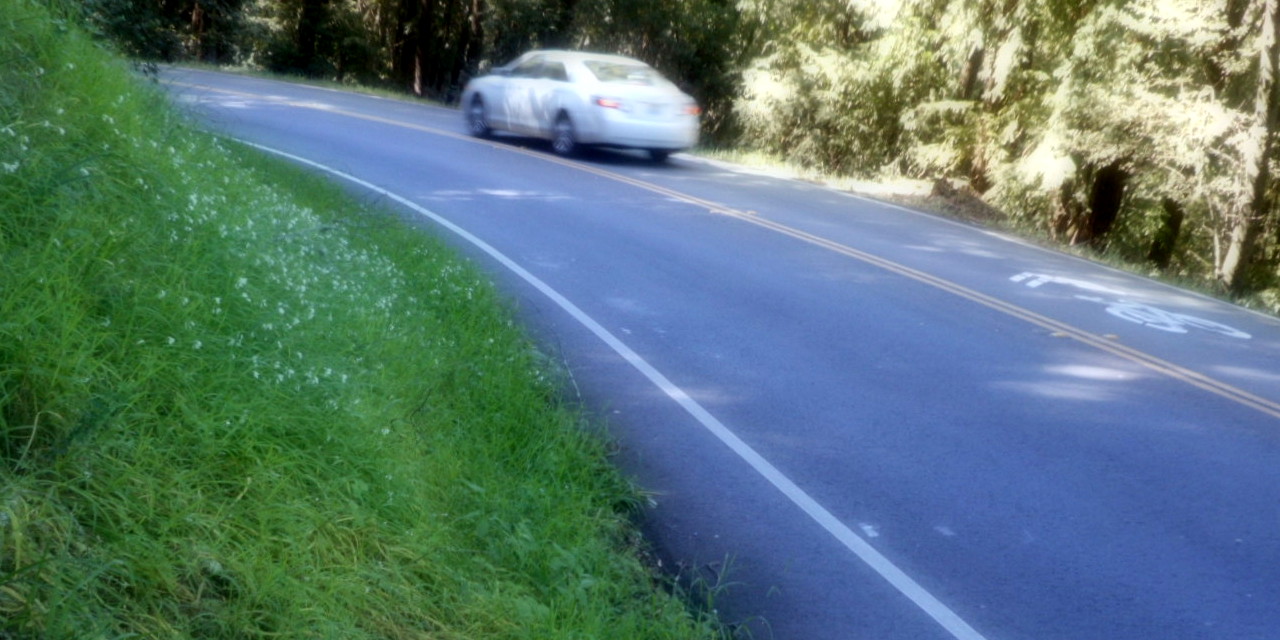
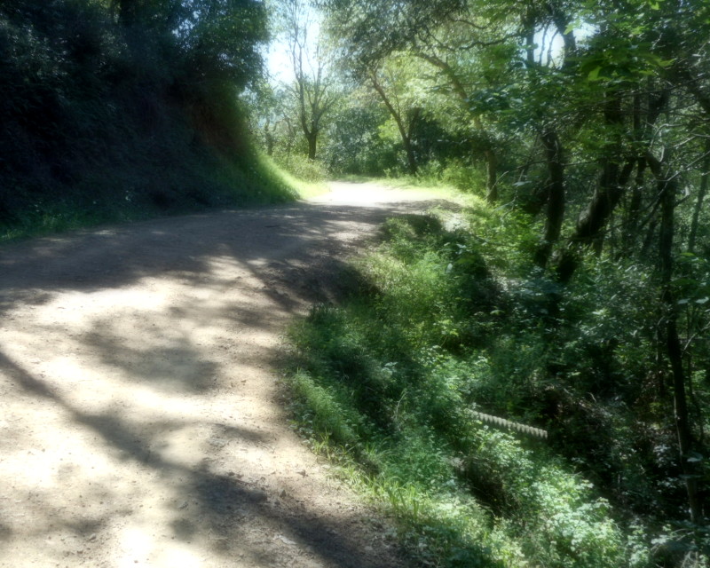
Then the trail ended. Well, really, it continued, but was chained off. Signs read: No Trespassing; Restricted Area. But. Google Maps said this was a legit trail. Nancy's Bay Trail map said it was a legit trail. Some "No Trespassing" signs mean "No cars unless you're a ranger" But. What if this trail ran into a big fence? I didn't want to start my Big Walk with a Big Backtrack.
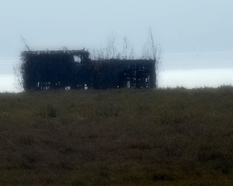
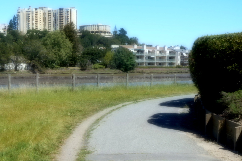
I stepped over the chain, kept walking along the trail, still not sure I was doing the right thing. I encountered other people, people who didn't look like rangers. Did that mean it was OK to be here? These people seemed clueless, like they might be halfway lost themselves, prosperous Marinites with worried expressions. I kept walking. To the left was brush and the bay; to the right, cultivated fields. There were strangely-constructed scraggly-looking shacks by the bay. Duck blinds? Boat shacks? I didn't see an easy way to a closer look, wasn't enthusiastic to stray from this chancy trail.
Eventually, this trail encountered another. The other trail was pretty clearly public, with plenty of folks walking it. Here, no sign warned that the trail I'd been on was off-limits. Perhaps I hadn't been trespassing after all.
The new trail was more clearly labeled. Thus, I learned out that I was walking by the treatment ponds of the Las Gallinas Valley Sanitary District. Had those cultivated fields been growing on sewage sludge, maybe extracting some toxins? Maybe.
I made my way out of the sewage treatment plant, past the place that looked like a low-security prison (but turned out to be a detox center), and made my way to McInnis Park.
Despite taking the scenic route, I'd shown up a half hour before the batting cages opened. Could I claim credit on my itinerary for visiting the batting cages if they weren't open? Should I wait around half an hour for them to open? There wasn't much else going on in this park. It could be a long half-hour.
My walk had a system. But I was still figuring out how that system should work.
It occured to me that since I was a morning person, I could expect to run into this issue often in the days to come: a set of closed itinerary choices. If I waited for one to open each time, I wouldn't make much progress before 11am. But this was a good time of the day for walking, before the sun things heated up. The walk was the thing. Keep walking.
I kept walking.
My set of destination choices for northern San Rafael: the San Rafael Farmer's Market (not happening this day), the Marin Center Veterans Memorial Auditorium (with a performance of Mary Poppins in the evening—many many hours in the future), the City of San Rafael (last resort choice), or the Osher Marin JCC, which had a cafe. I didn't really think Foursquare folks checked into the JCC for the cafe; they were probably going there for classes they'd prearranged and special events that weren't occuring mid-day on a Friday. Those classes probably weren't so drop-in-able. But of the choices I'd given myself, thanks to its cafe, The Osher JCC seemed most fit.
The Osher JCC was near the Marin Civic Center area. Here around McInnis park, the terrain was pretty wetlandish. There might not be a direct route from point A to point B that didn't involve wading across a creek. Thus I wasn't so surprised when Google Maps routed me walking back out to Highway 101, along a noisy frontage road, and then bayward again to reach Civic Center: there wasn't a direct road.
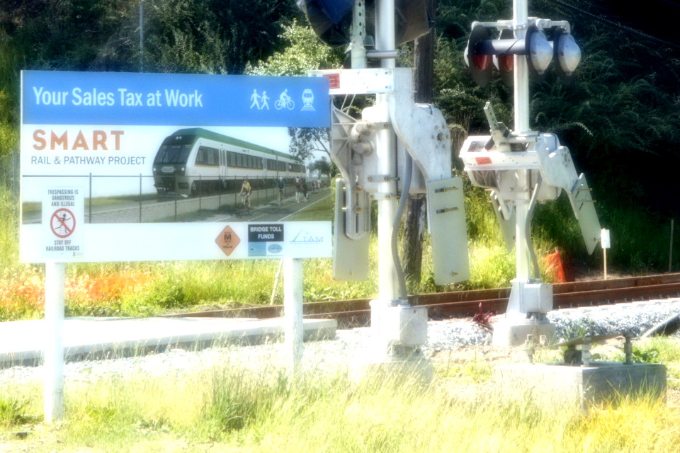
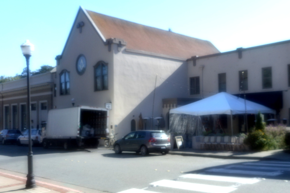
But when I reached the Civic Center area, walking past Autodesk HQ, I saw a sign that in the future there might be a direct route: a sign for SMART. Marin was getting a new system of trains and bike paths. I'd crossed its route twice, once on the way to Highway 101 and once on the way back. If that trail had already been built, it would have saved me some frontage road noise.
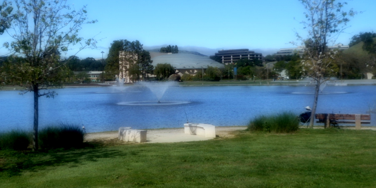
At Civic Center, I walked past the war memorial on the Avenue of the Flags, a puzzle pick-up spot at a recent Shinteki puzzlehunt. I walked up to the Civic Auditorium. Maybe I wasn't going to wait around for the evening's show, but I could still look at the architecture. The front door was open, so I poked my head in to see the entry room. The entry seemed cramped; maybe I experienced the auditorium the best way by seeing it from the outside?
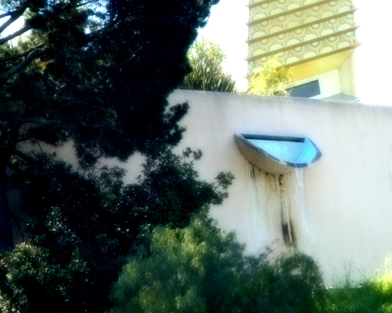
I walked through the Civic Center park, then looked up at the architecture of the Civic Center building. My attention was drawn to a waterfall coming out of one wall. I hadn't noticed the waterfall at first—it was hard to see. This raised the question: why keep such a subtle water feature running during a drought? I scowled at the waterfall. Maybe the heat was making me cranky.
I walked up Santa Venetia's San Pedro road and into the Osher Marin JCC. To get further into the JCC, a sign said I was supposed to sign in at the front desk; and to reach the rest of the building, I'd have to go through a closed door, so perhaps they were serious. But but the exception to that was the cafe, just off the lobby, through an open door.
I ordered a breakfast sandwich although it was almost noon. The sandwich was frozen in the middle. I'm pretty sure I was supposed to microwave it. But I'd been walking through the heat for the past few hours. The cold crunchy texture of frozen egg felt pretty good. It was good to be inside, out of the sun for a few minutes. I sat, ate, and fiddled with phone and papers, figuring out where to go next.

My choices for the next leg were China Camp State Park (which, thanks to a previous walk, I knew I'd exit in an area with bad mobile data reception), The Grate Room at Terrapin Crossroads▼ (not open until evening), or Sol Food Puerto Rican▼. Surely I'd burn off my Osher calories on the way to Sol Food; surely two eateries in a row wouldn't be that excessive (wrong). I plotted a course to Sol Food.
You might wonder what those ▼triangles meant. Remember that I'd put together my choices for each region by searching Foursquare for recommendations close to some spot every few miles along a route around the bay. Some neighborhoods were not dense with popular places; some places were very popular indeed. Thus, Foursquare might recommend the same place for two adjacent "neighborhoods". I decided that visiting such a place would "count" for both neighborhoods. By visiting Sol Food Puerto Rican in downtown San Rafael, I was also taking care of South San Rafael. There my choices would have been Sol Food, Grate Room (closed, you remember), Bullseye Precision Shooting Range (could someone who didn't know how to shoot just drop in?), Albert Park Baseball Field (solitaire baseball? is that a thing?). Seeing these choices, I liked the one-place-can-count-for-two-neighborhoods rule. On the itinerary printout, I'd marked these two-neighborhood places with ▼triangles.
Thus, I had my next goal: Sol Food Puerto Rican in downtown San Rafael.
I backtracked along San Pedro road, navigated the sidewalk under Highway 101, walked down tree-shaded streets until I reached the harsh bike path that paralleled the 101, escaped that to the not-so-harsh Lincoln Ave, and was soon in downtown San Rafael. I walked up to Sol Food, placed an order at the counter. Then I noticed that I'd walked into the to-go section. If I'd walked past it to the corner, I would have noticed the sit-down restaurant. I'd messed up. Or had I? The line was out the door at the sit-down restaurant. Maybe carrying a sandwich a few blocks away to a park was a smart move. Anyhow, that's what I did: I walked a few blocks to Albert Park (arguably checking off Albert Park Baseball Field from the itinerary), and ate my sandwich, which was pretty tasty.
A guy on the next bench over, either drunk or crazy, wanted to talk. Specifically, he wanted to know how I drew guns. Did I do so in the manner of Clint Eastwood? I smiled and shrugged.
My next set of choices was Town of Corte Madera (last resort), Sweetwater Music Hall▼ (I'd be too early for music, but they had a cafe that would be open if I walked slow), or Blue Barn Gourmet (a restaurant with a branch in San Francisco I could visit any time I wanted). I was full from my sandwiches, but Sweetwater seemed like best choice.
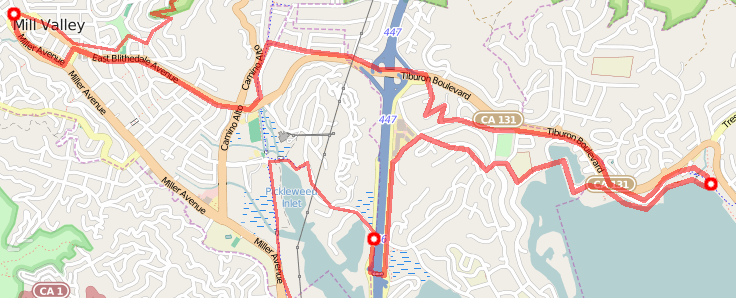
I made my way through San Rafael's streets. When the road wound its way up into the hills, I followed. When it descended from the hills and landed me on Sir Francis Drake Blvd, I perservered, walking across a pedestrian overpass. Google Maps said there was a bike path to follow from there, which I had trouble spotting—but there was a family dragging a wagon of playground items behind them, surely they were going the right way. Thus I navigated to Creekside Park, along Bon Air Road across Corte Madera Creek, and to Larkspur's Magnolia Ave. Magnolia seemed too busy at first, so I went onto a little bike path for a couple of blocks, emerging by the Raquet club. Then I kept going along Magnolia (not noticing that Google Maps wanted be to turn onto Holcombe) and saw Larkspur's fancy old buildings. The fancy old buildings were probably more interesting than the route I was supposed to take.
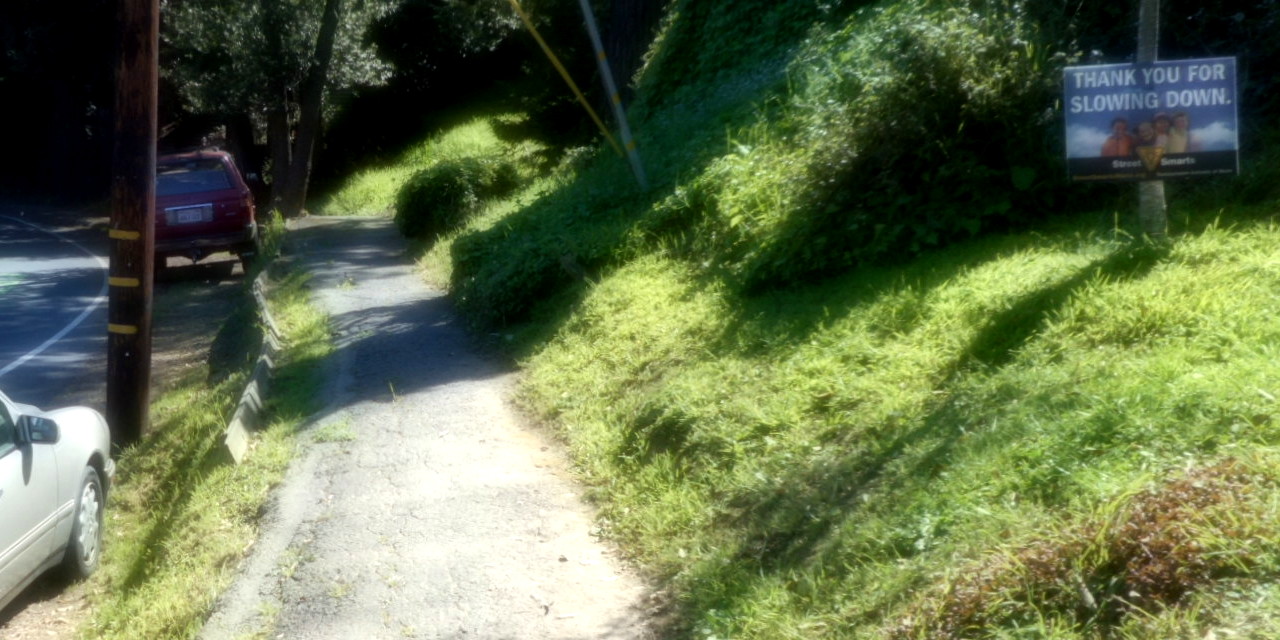
I followed Magnolia up into the hills. After a while, the sidewalk disappeared; this road didn't have much of a shoulder and cars seemed eager to take it quickly. Houses had signs up: "Thank you for slowing down". That's suburban code for "Please don't drive so recklessly." Did I want to continue this way? Slowing down to think it over, I saw a trailhead marker for Camino Alto OSP. Aha, I could walk along the trail instead of at the edge of this road. It wouldn't be the most direct route—I'd been in Camino Alto OSP before, and had gotten pretty turned around and lost—but at least I wouldn't be dodging cars.
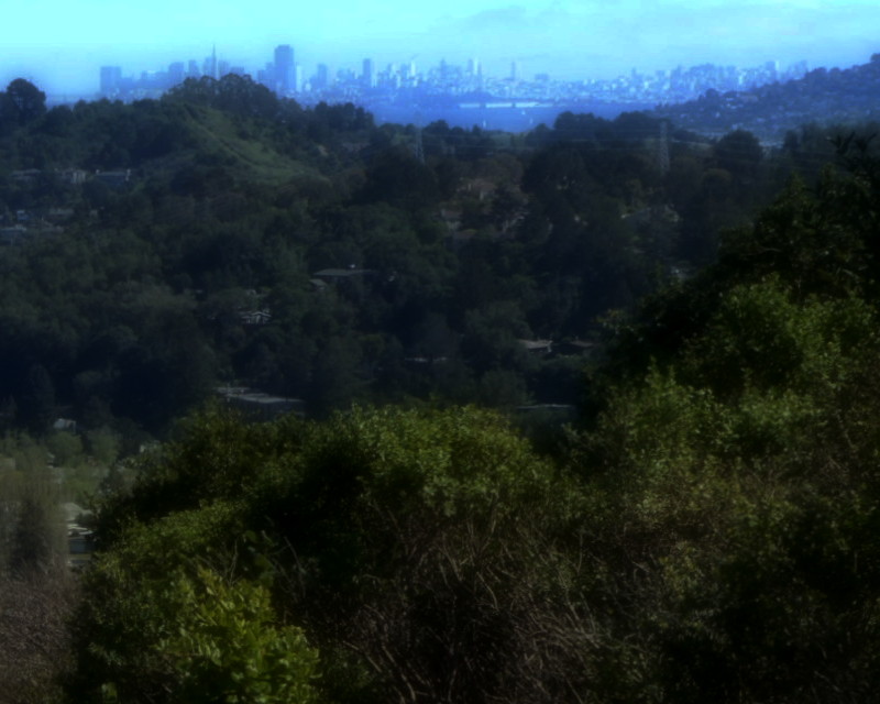
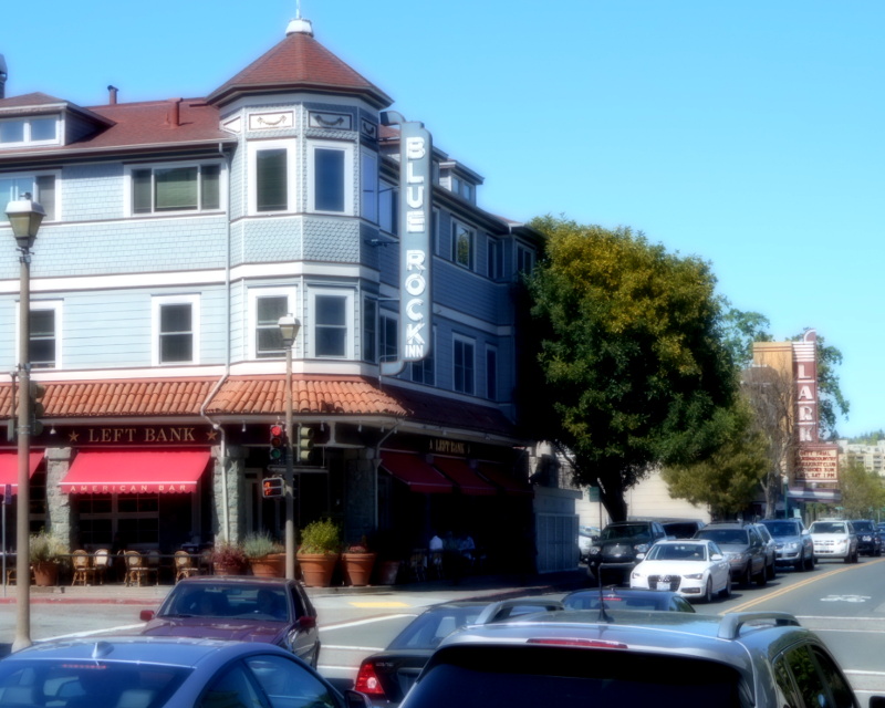
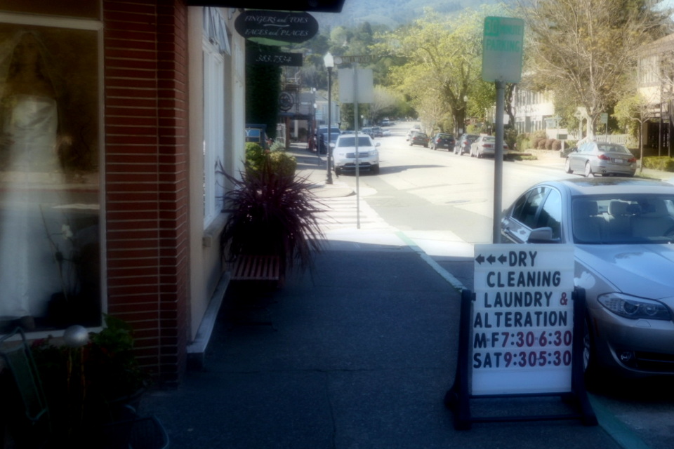
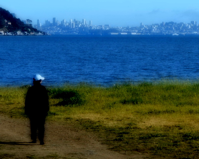
And so I walked up and through the woods. And then down and through the woods. Sometimes a view would open up through the woods and I got a sneak preview of future destinations: there was San Francisco. I descended further, emerged from the park, made my way down through Mill Valley's streets, came to Boyle Park where things started to look familiar. Along Blithedale past Tony Tutto's two-tone sign to central Mill Valley, where I reached Sweetwater which had a sign out front: Closed for Private Event.
Closed. Sweetwater was closed.
Did this count as a "visit" in my system? Should I visit one of the other choices instead? Did I want to backtrack to the Town of Corte Madera so I could check in there? That sounded like a lot of backtracking. I decreed that this visit-to-a-closed-place counted as a visit.
![]()
My next set of choices was Blackie's Pasture, Fish (seafood restaurant, often not great for vegetarians), and the Bay Model (closed for the afternoon). The idea of visiting the Bay Model to walk around its model of the bay as part of a walk around the real bay was pretty nifty. But it was closed, so instead I set out for Blackie's Pasture, a park on the Tiburon peninsula. It wasn't such an interesting spot to visit (more interesting for its charming history than anything happening there now). But maybe it was the best choice. I started walking.
Despite Sweetwater's being closed, my visit to Mill Valley wasn't a complete loss. Mill Valley has other stuff going on. I swung over to Illumigarden to gawk at the sculptures for sale. Kids were out of school, tearing around. It was energizing just to watch them. A lady asked me if I had the time and I realized that, even though I was miles inland to visit a place that was closed, this walk was definitely how I wanted to spend my time right then.
I made my way back to Blithedale and bayward. Thanks to a previous walk in the area, I looked for and found a bike path to get pass the sidewalk-less part of Blithedale.
By the time I made it over Highway 101, rush hour traffic had arrived. Blithedale became Tiburon Blvd, the shortest way, but noisy with growly rumbling impatient commuters. I headed down a side street into the hills above Strawberry Village and meandered my way variously pasturewards. Eventually, a creek forced me to once again emerge out onto Tiburon Blvd for a block, but soon I escaped onto the familiar quiet of Greenwood Cove Drive.
Past the old Lyford House and the Audubon Center. Past boring residences, soon I arrived at Blackie's Pasture, a fine site for puzzle hunt puzzles, bicycle ride stops, and now a check in on this big walk.
It was getting on towards evening. It was time to figure out plans. The Golden Gate Bridge doesn't let walkers on after sunset, and Google Maps said I couldn't walk there in time. It was time to figure out lodging. Google said the nearest cheap lodging was the Travelodge on Strawberry Village, so I backtracked there, got a room, dropped off my pack. I had fond memories of the Pasta Pomodoro in that shopping center—when Mystic Fish had solved a puzzle there, the food had come quickly enough such that we hadn't had to make any eat-or-make-progress choices. When I went there this evening, I didn't get fed so quickly, but that was because the line of folks waiting to get in stretched out the door. Pasta Pomodoro in Marin County on a Friday night is pretty bustling. I waited it out, had some pasta, wasn't sorry.